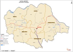
Following is the official map of new Jagtial District in Telangana. Jagtial district is carved out from the existng Karimnagar district. Jagtial will be the district center and other important towns in the district are Koratla, Dharmapuri, Vemulawada, Choppadandi, Jagatial etc.
The Jagtial district map indicated new boundaries, mandals, assembly constituency boundaries, rivers, state and national highways, rail transport etc. The public can post the suggestions and objections on Jagtial district to the Government through the website www.newdistrictsformation.telangana.gov.in .
Also Read for more information:
New Districts, Revenue Divisions and Mandals in Telangana State – 2016
