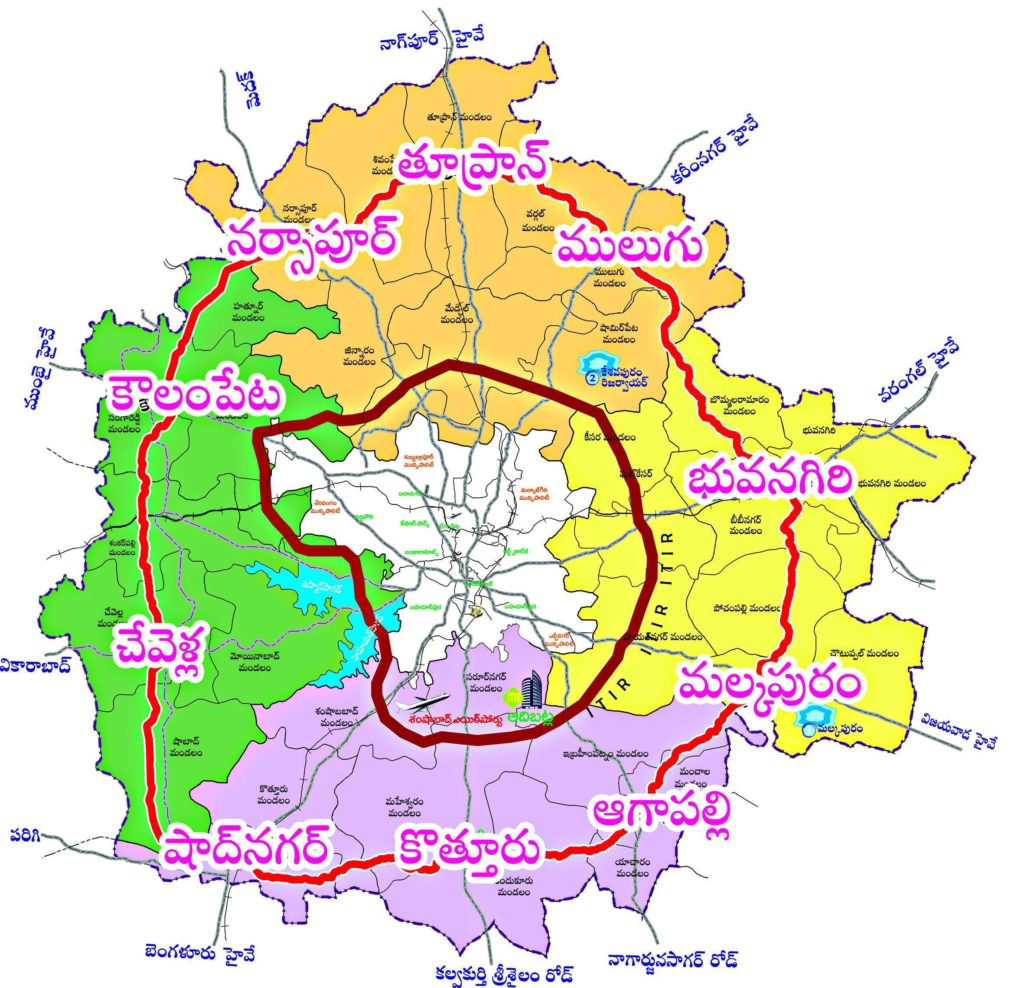
RRR is the latest buzz in Hyderabad. It’s not about RRR movie of SS Rajamouli, it’s the proposed RRR (Regional Ring Road) which connects many sub urban areas of Telangana to Ring Road and Hyderabad. The RRR spreads into Rangareddy, Medak, Sangareddy, Mahabubnagar, Vikarabad, Nalgonda districts. Following is the latest map of RRR, Hyderabad.
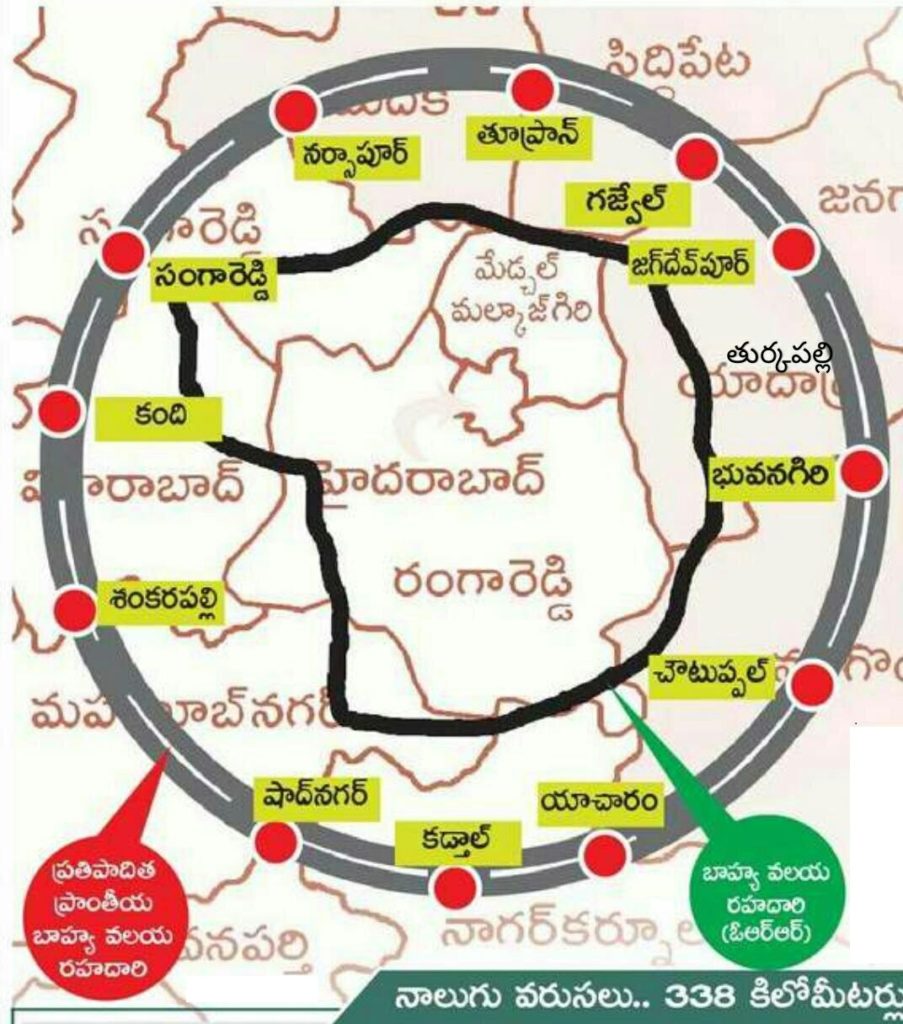
RRR Covers following Mandals and Villages:
Yacharam, Kadthal, Kandi, Shadnagar, Choutuppal, Bhuvanagiri, Jagadevpur, Gajwel, Narsapur, Toopran and other related areas are that connects RRR and ORR are Kollur, Patancheru, Shankarpalli, Mallampet, Dundigal, Shameerpet, Keesara, Bongulur, Tukkuguda, Gachibowli, Shamshabad, Ghatkesar, Pedda Amberpet, Sangareddy, Vikarabad, and several other areas.