Mulugu district is the new addition to the administrative overhauling in Telangana state. Telangana Government has issued Gazette notification forming Mulugu district. It is carved out from the existing Jayashankar Bhupalapally district. Following are details of mandals, villages in Mulugu district along with map including boundaries.
Mandals in Mulugu district:
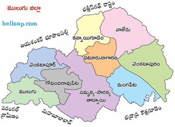
Mulugu district has Vajedu, Kannayigudem, Yeturu Nagaram, Venkatapuram, Mangapet, Venkatapur, Govindaraopet, Mulugu, Sammakka Sarakka Tadwai mandals. The new district shares its borders with Jayashankar Bhupalapally, Warangal rural, Mahabubabad, Bhadradri Kothagudem along with Chattisgarh state.
From 17 February 2019:
New Mulugu district comes into force from 17th February 2019. The headquarters Mulugu will have separate administrative set up with all the facilities. Total population of the Mulugu district is 2.94 lakhs. V. Venkateswarlu is the first collector (additional charge) of the district.
New Mandals:
Apart from the merge of mandals from other districts, Government is also proposed to form new mandals in new districts. Two to three mandals will be carved out soon from the existing mandals in the district.
With villages map not available ,,,,,.