In a major boost to the infrastructure development of Hyderabad, Government of India has approved Regional Ring Road (RRR) project of TRS Government in Telangana. The project cost is estimated at Rs.11000 crores.
Sangareddy to Kandi:
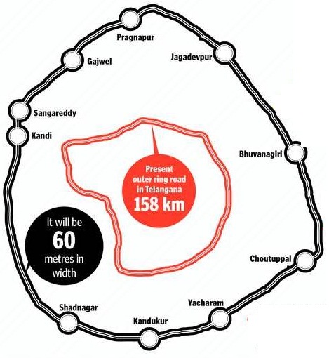
RRR is aimed at connecting the important areas outside existing Outer Ring Road (ORR). The Regional Ring Road passes through Sangareddy – Narsapur – Toopran – Gajwel – Jagadevpur – Bhuvanagiri – Choutuppal – Ibrahimpatnam – Chevella – Shankarapalli – Yacharam – Kadthal – Shadnagar – Kandi – Sangareddy.
338 Kilometers:
Total breadth of RRR is 338 kilometers. The works will be taken up under the supervision of National Highways Authority of India (NHAI). The project is the result of consistant pursuance of TRS MPs at the central level. Out of total 338 kilometers, cost of 70 kilometers will be the responsibility of state government and remaining has to be be from the exchequer of NHAI.
The RRR map is not visible clearly with regard to existing roads ,railway tracks etc. .
Will the RRR impact existing plot layouts? We are hearing that a 5 kilometer Growth corridor is planned on both sides of the RRR which will be surveyed and the land use will be finalized by govt. . We are also told this growth corridor is applicable to ORR. Can somebody clear the doubts please?
can you please explain from which village regional ring road is passing near toopran .
Please give me Kesampet village rrr
map with survey numbers
Sir please chevella to kandi rrr route all villages
Names